![]() https://www.geospatialecology.com
https://www.geospatialecology.com
Research directions
Natural capital accounting
We use a variety of satellite, airborne and ground-based sensing tools to measure and monitor the ecosystem services that landscapes provide. Key research lines include quantifying carbon sequestration, greenhouse gas emissions mitigation, and soil erosion management.
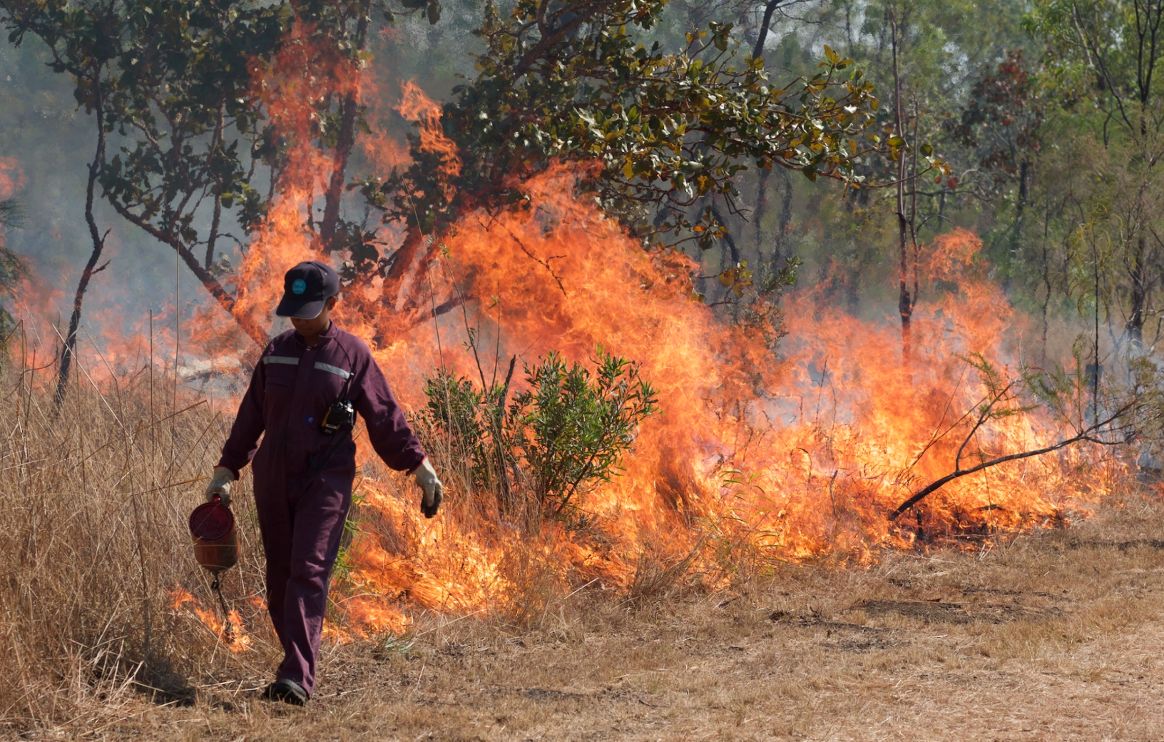
Carbon markets are maturing around the globe, and in northern Australia we see increased uptake of incentives to reduce greenhouse gas emissions through savanna burning. However currently the reductions in emissions that are achieved and paid for via savanna burning methods rely on modelled outputs. We aim to bring greater rigour to these markets by quantifying actual changes that occur following fires, and reducing uncertainties in modelled estimates.
Trajectories of ecosystem change
Ecosystems structure is constantly change through time, and the tropical savanna zone is particularly dynamic. Rainfall, fire, cyclones, grazing and land-clearing all interact to drive change in ecosystem state. Understanding the natural dynamics of ecosystems is a critical step in managing them into the future, and in quantifying the effects of changing climate and lan-use practices on ecosystem health.
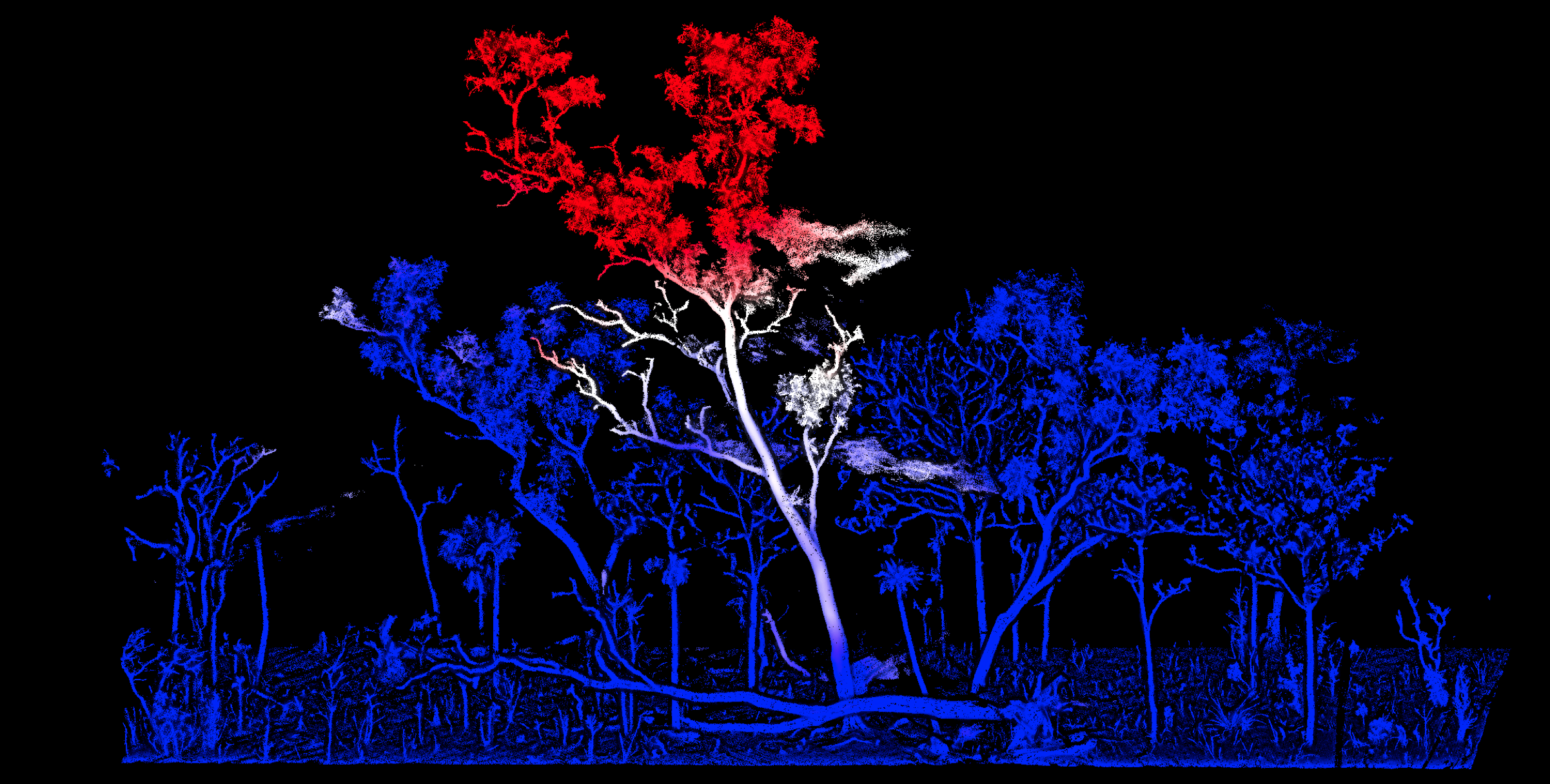
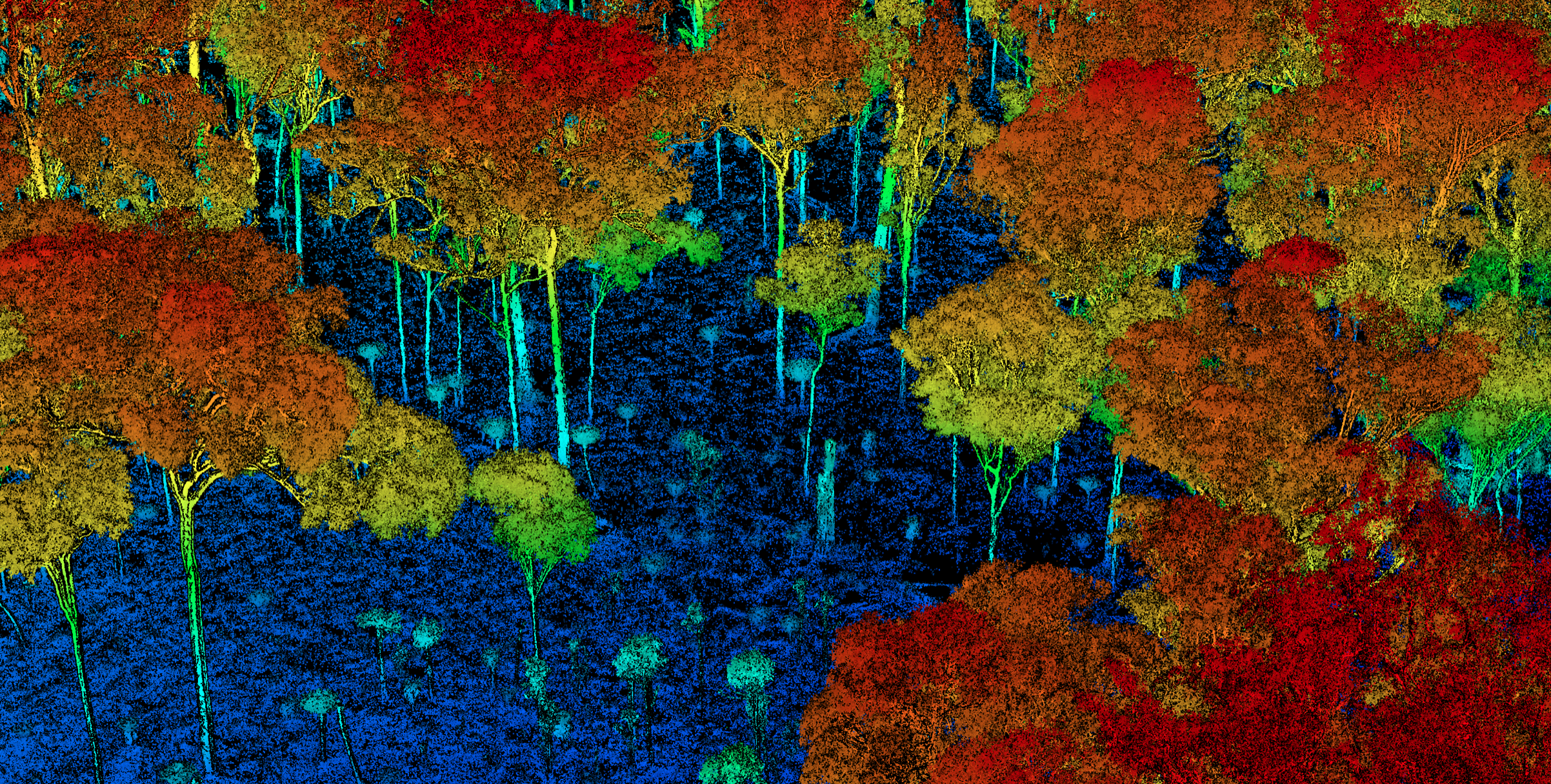
We use Reality Capture technologies to map ecosystem structure in three-dimensions and trace their trajectories through time. Our research uses time-series of terrestrial LiDAR data and satellite based RADAR systems.
Biodiversity conservation
Vegetation structural diversity is a fundamental component of biodiversity. Diverse plant structures create broad arrays of habitat for other organisms to utilize, and increase the range of ecological functions that vegetation provides. In order to conserve biodiversity and ecological functioning under global change, we need to better understand how variation in climate and land-use influence ecosystem structure and dynamics. Growing appreciation of the importance of spatial scale, heterogeneity and context in ecological research has seen a rapid increase in the application of remote sensing in ecology to provide spatially continuous representations of ecosystems.
LiDAR (light detection and ranging) has emerged as a valuable tool for the structural characterization of ecosystems in three-dimensions (3-D), at fine resolutions, and over large spatial extents. However, despite large advances in mapping canopy structure in high spatial resolution, we have seen limited direct application of LiDAR in biodiversity research. This disparity partly stems from the collection and analysis of LiDAR data remaining largely in the remote sensing, engineering and computer science fields, with poor integration into ecological and biodiversity science.
We aim to develop better insight into how biodiversity and ecological functioning might change under future climate and land-management conditions. We are using combinations of high-resolution terrestrial and airborne LiDAR to explore the variability in tree architecture across gradients of land-use and climate in tropical ecosystems. The architecture of an adult tree is a reflection of current and historic growing conditions, as it integrates the environmental and disturbance factors that have shaped its structure from seedling to maturity. We can use this information embedded within the 3-D canopy structure of trees, at multiple spatial scales, to better understand how different drivers influence carbon storage and structural diversity.
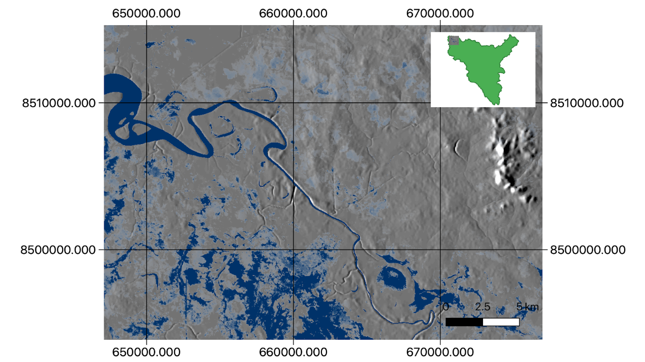
Floodplain hydrology
We aim to improve understanding of the hydrology and environmental flow requirements of the large rivers draining northern Australia. These systems are unique and complex, and their dynamic nature makes then difficult to characterise and model.
We are using a variety of spaceborne remote sensing tools to map surface water extent and derive frequency of inundation patterns for the Daly, Adelaide, Mary, South Alligator, and Roper rivers.